Oceania
| Caution: The Internet is not part of the Maritime Safety Information's operational data stream and should never be relied upon as a means to obtain the latest forecast and warning information. Access to the Site may be interrupted or delayed from time to time, update may also experience occasional gaps. Please refer to OFFICIAL sources, Inmarsat SafetyNET or international NAVTEX services, for more complete information. |
METAREA X/XIV
| NAME | DATE |
|---|---|
| Gale Storm Warning South 25S | July 09 2017 - 04:59:17 UTC |
| Gale Storm Warning South 25S | July 09 2017 - 04:59:17 UTC |
| Gale Storm Warning South 25S | July 09 2017 - 04:59:17 UTC |
| Gale Storm Warning South 25S | July 09 2017 - 04:59:17 UTC |
| Gale Storm Warning South 25S | July 09 2017 - 04:59:17 UTC |
| Ice Accretion Warning Area Southern | July 09 2017 - 04:59:17 UTC |
| Gale Storm Warning South 25S | July 09 2017 - 04:59:16 UTC |
| Gale Storm Warning North 25S | July 09 2017 - 04:54:27 UTC |
Gale Storm Warning South 25S - July 09 2017 - 04:59:16 UTC
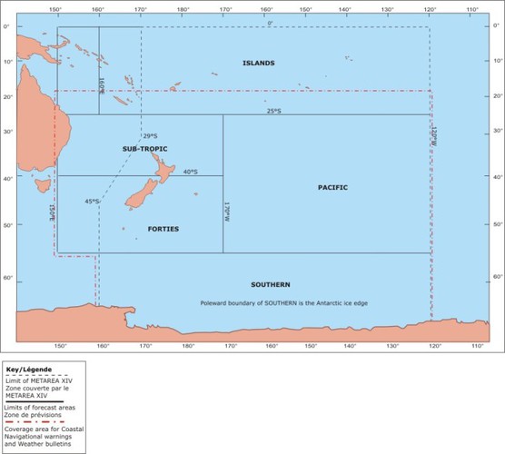
WWNZ40 NZKL 090652
GALE WARNING 186
THIS AFFECTS OCEAN AREA: SOUTHERN
AT 090600UTC
OVER WATERS NORTH OF ICE EDGE.
IN A BELT 300 NAUTICAL MILES WIDE CENTRED ON A LINE 63S 145W 61S
128W 60S 120W: WESTERLY 35KT.
GALE AREA MOVING EASTNORTHEAST 35KT.
THIS WARNING CANCELS AND REPLACES WARNING 182.
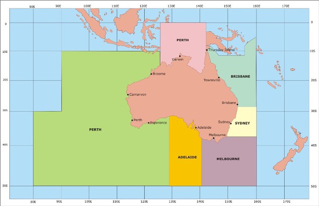
Sea regions: METAREA X
Metarea map
Sea regions: METAREA XIV
Metarea map