|
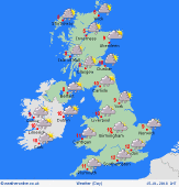
 Sunday Sunday
A generally dry day with light winds across central and southern Britain. Rather murky, with some fog patches possible. Cloud breaking to give occasional sunshine. Toward the west & north, generally more cloud and a risk of spots of rain. Fronts moving in from the Atlantic bring strengthening southwesterly winds and rain will develop for western Scotland and Ireland, turning heavier into the evening. Highs 5 to 8C, locally milder south-west.
 Sunday night Sunday night
Widespread rain affects western regions overnight, heaviest falls over the hills in the west & north-west. Snow over the higher Scottish mountains. Outbreaks of rain extend into central Britain before dawn. The south-east stays dry. Showers follow into Northern Ireland and western Scotland. Brisk southwesterly winds, local gales around coasts in the west. Lows 1 to 5C, temperatures may rise slightly from the west as rain moves in.
 Monday Monday
A frontal system advances eastwards across England, bringing rain for several hours, some heavy bursts. Gales around the English Channel. Rain will gradually clear from the west, with some sunshine breaking through for Wales and northern England. Showery for western coasts of Britain and Ireland, falling as snow or hail to increasing low levels as colder air arrives. Reaching 10C for many, then temperatures dropping from the west to 5C.
 Tuesday Tuesday
A strong and cold westerly wind. Widespread and frequent heavy showers, merging to constant precipitation in all western regions - snow or hail falling to low levels, accumulating over the hills. Possible thunder, especially near western coasts. A risk of ice. Brighter toward the Midlands, with sunny intervals and eastern counties may stay dry all day. Top temperatures just 3 to 6C, but feeling sub-zero in the wind.
|
