|
 Sunday Sunday
An unsettled day overall. Early rain in the north-east clears into the North Sea. Areas of heavy showers in the west from early morning will advance east & north-east across many areas into the afternoon, giving some thundery downpours, locally merging into a longer spell of rain. Eastern England should be dry for many hours, and the far south-east may escape largely dry all day. Blustery south-westerly winds. Highs 16 to 21C.
 Sunday night Sunday night
Showers will continue overnight in the north & west of Britain & Ireland as various troughs rotate around low pressure to the north-west - locally frequent rain on windward coasts. Elsewhere, daytime showers should fade and clear eastwards during the evening. Clear spells developing. Remaining breezy, gusty south-westerlies around western coasts. Temperatures dipping to 10 to 13C, locally 7 to 9C in rural areas in Scotland.
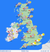
 Monday Monday
Low pressure lies across northern Britain. Frequent showers for Scotland, Ireland and western areas of England & Wales, at times merging into a longer spell of rain over the hills. A scattering of showers likely to advance east across central & southern England, although eastern counties should stay mainly dry with occasional sun. Breezy, south-westerly winds, strongest in the west. Highs 14 to 18C west & north, 19 to 22C south & east.
 Tuesday Tuesday
Slack pressure across the country. Troughs bring a showery pattern again for west & northern Britain, also much of Ireland. Some locally frequent rain over western hills. Toward the Midlands, south & east of England, there should be just a few scattered showers, and plenty of dry and bright weather with sunny spells. Winds light southwesterlies, although gusty near Irish Sea. Highs 15 to 18C north & west, 21 to 24C south & east.
|
