World
North America
- Canada
- USA
- Alaska and Hawaii
- Middle West
- Northeast
- South
- » Alabama
- » Arkansas
- » Delaware
- » Florida
- » Georgia
- » Kentucky
- » Louisiana
- » Maryland
- » Mississippi
- » New Mexico
- ⇓ North Carolina
-
- Ahoskie
- Albemarle
- Andrews
- Asheboro
- Asheville
- Beaufort
- Burlington
- Cape Hatteras
- Cary
- Chapel Hill
- Charlotte
- Clinton
- Concord
- Currituck
- Dare County Gunnery Range
- Edenton
- Elizabeth City
- Elizabethtown
- Erwin
- Fayetteville
- Fort Bragg
- Gastonia
- Goldsboro
- Greensboro
- Greenville
- Hatteras
- Havelock
- Hickory
- High Point
- Jacksonville
- Jacksonville
- Jefferson
- Kenansville
- Kill Devil Hills
- Kingston
- Lexington
- Lincolnton
- Louisburg
- Lumberton
- Mac Kall
- Manassas
- Manteo
- Maxton
- Monroe
- Morganton
- Mount Airy
- New Bern
- North Wilkesboro
- Oxford
- Pope
- Raleigh
- Roanoke Rapids
- Rockingham
- Rocky Mount
- Rowan Mills
- Roxboro
- Rutherfordton
- Sanford
- Shelby
- Siler City
- Smithfield
- Southern Pines
- Southport
- Statesville
- Stoney Creek
- Swansboro
- Tarboro
- Wadesboro
- Washington
- Whiteville
- Wilmington
- Winston-Salem
- » Oklahoma
- » South Carolina
- » Tennessee
- » Texas
- » Virginia
- » West-Virginia
- West
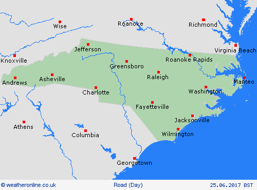
North Carolina

Last updated: Tu, 16 Apr, 16:02 BST
Note: Temperature forecast is minimum temperature at ground/road surface - NOT air temperature.
See also Driving in winter.
| Key to WeatherOnline's road forecast symbols showing the effects of the weather forecast on road conditions. | |||

|
dry roads |

|
damp roads |

|
wet roads |

|
aquaplaning |

|
hard-packed snow |

|
freezing rain/moisture |

|
hoar frost |

|
black ice |

|
fog | ||
Forecast
Maps
